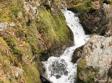
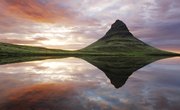
A landform is a broad term referring to a geological feature on the earth’s surface, such as mountains, tors (vertical crags of rock), plains, hills and valleys. Landforms are usually formed over thousands of years, by movement of the earth’s plates and/or by erosion . Landforms can be found throughout the world and can be used for a variety of practical and recreational purposes. As landforms are natural features their use is often restricted by heritage or Government organizations. Check with the relevant authorities before harnessing a landform for personal or business use.
Mapping
Landform, or topographic, maps are an important tool for geographers and cartographers (map makers). These maps use elevations and physical features as cartographic tools to distinguish locations, particularly in rural settings with few towns or villages. Typically, contour lines are used to distinguish the height and location of landforms which then form the basis for navigation. These maps can be two or three dimensional and are drawn at a variety of scales, typically 1:24,000. They can be used by backpackers and hikers to navigate across the countryside as well as by property developers to avoid natural hazards and determine the appropriate location for new settlements and dwellings. They can also be used by fisherman and hunters to locate remote drainage areas.
Adventure Tourism
The size and geological formation of landforms, such as volcanoes and tors, make them a popular adventure tourist destination. Hiking trips and adventure challenges are often based around landforms, such as the Three Peaks Challenge in the United Kingdom, where you have to trek to the top of three landforms. Rock climbing up, or abseiling down landforms is another popular activity and, for the more adventurous, some tour companies offer potholing and caving trips. For all of these activities it is best to start with beginner level programs, before progressing to more complex and dangerous landforms.
Renewable Energy
Geothermal energy is a renewable energy source obtained from hot rocks deep underground. Landforms, particularly volcanoes, are key sources of geothermal energy and so landforms, and the areas surrounding them, are often harnessed for electricity and hot water production. Another renewable energy source, wind power, can be harnessed using farms built in elevated areas. Landforms are often in the ideal location for these wind farms as they are in remote, windswept locations at high altitude. Renewable energy, unlike coal, oil and gas, is made from resources that occur naturally and so will not run out or pollute the atmosphere.