
People often confuse weather with climate, but they are not the same, though they share common components. Elements of weather and climate include measurements of wind speed and direction, type of rain and amounts, humidity levels, air pressure, cloud cover, cloud types and air temperatures. Weather represents the daily changes in the atmosphere or the state of the atmosphere over a short period, while climate represents the combination of multiple weather patterns of a specific location averaged over several years. Scientists postulate that both daily weather and climates are in the process of changing because of human intervention and nature.
TL;DR (Too Long; Didn't Read)
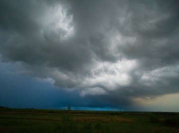
On any given day, the weather dictates what you wear if you plan to go outside. A quick glance at the conditions and you may say, “It’s warm outside, you don’t need a coat.” But without checking the daily weather report, you may not know about the incoming storm later in the afternoon. Weather changes daily or hourly in some locations. Climate doesn’t change as rapidly as weather does because it’s a compilation of several years of recorded weather conditions like rain, air pressure, humidity, wind, snow, sun and temperatures. They're totaled and averaged to give an idea of the climate you can expect in a specific area.
Atmospheric Elements
Scientists use satellites and weather stations to capture and record the changes in the elements of weather. Multiple devices measure wind speed and direction and high- and low-pressure areas. Barometer readings signify an increase or decrease in air pressure, while hygrometers calculate the amount of moisture in the air. Thermometers reveal whether it’s hot, cold or somewhere in between. Cloud identification and the percentage of cloud cover, combined with all the other readings, tell a meteorologist all she or he needs to know to predict the daily weather.
National Centers for Environmental Information
The National Oceanic and Atmospheric Administration provides the National Weather Service with data collected from land-based weather stations around the globe to make weather predictions on a daily basis. These land-based weather stations house instruments that collect and record data hourly and include such sensors as:
- Thermometers: Devices that measures air temperature.
- Hygrometers: Sensors that assess relative humidity, which is the quantity of water in a gas form in the air. Humidity plays a role in determining rain, fog, dew points and heat indexes.
- Barometers: They signify the pressure in the atmosphere. When the barometer drops, and it changes from high to low air pressure, it typically signifies a coming storm.
- Anemometers: These sensors spin on a vertical axle with a wheel-like structure at the top and small cups at the end of each spoke that catch the wind and measure its speed.
- Wind vanes: They indicate the direction in which the wind blows.
- Rain gauges: They calculate the amount of rain that falls during a given period.
Land-based weather stations automatically track and collect this information and record it in a database. Once interpreted, the data collected allows the meteorologist to make weather predictions for a day or a week. Several years’ worth of this data collected and averaged provide the data that makes up the climate of an area.
Climate Vs. Weather
The climate of the Anza-Borrego Desert in Southern California, for example, averages 6.18 inches of rain per year and a monthly mean temperature of 72 degrees Fahrenheit. During the summer months, the monthly mean temperature has no meaning when the thermometer records temperatures at 120 degrees Fahrenheit in the shade. This is the difference between looking at climate and weather. It might also surprise you to learn that July, August and September represent the monsoon season in this San Diego County desert. Flash floods temporarily wash across the desert landscape in a brown muddy flow and in just a few days, the annual precipitation amounts are met.
References
About the Author
As a journalist and editor for several years, Laurie Brenner has covered many topics in her writings, but science is one of her first loves. Her stint as Manager of the California State Mining and Mineral Museum in California's gold country served to deepen her interest in science which she now fulfills by writing for online science websites. Brenner is also a published sci-fi author. She graduated from San Diego's Coleman College in 1972.
Photo Credits
extreme weather image by Calin Tatu from Fotolia.com