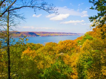
The Piedmont is the province farthest east of the Appalachian Mountains, stretching 1,000 miles between southern New York and Alabama. A transitional upland bridging higher country to the west and the low woods and swamps of the Atlantic-Gulf Coastal Plain eastward, the Piedmont zone is generally a low, rolling plateau strung with shallow valleys. Several landforms are particularly notable in the region. The geography of the region -- and the unique and notable landforms -- defined the way the region was traversed and lived in by Native Americans, and those same traits would shape the way later European cities were built.
TL;DR (Too Long; Didn't Read)
The Piedmont zone of the North American continent is a varied plateau set between a number of mountain ranges. Notable landforms in the area include monadnocks like Georgia's Stone Mountain, the Palisades on the Hudson River, and the Fall Line that defined trade and European settlement in the region.
Piedmont Zone Geography
To the west of the Piedmont zone lies the more rugged terrain of the Appalachian Mountains. At its southern toe in Alabama and Georgia, and in its northwestern extent in Pennsylvania the region borders the Valley and Ridge province. In between those abutments, the Blue Ridge Mountains line the western Piedmont from northern Georgia to southern Pennsylvania. Some of the Appalachian Mountains’ most imposing, high-relief ranges lie in the Blue Ridge province, including the Great Smoky Mountains along the Tennessee-North Carolina line and the Black Mountains of North Carolina, which include the chain’s highest summit, the 6,684-foot Mount Mitchell. The Piedmont’s northern end abuts the New England province of the Appalachians.
Coastal Plain Fall Line
The eastern boundary of the Piedmont constitutes one of the great topographic frontiers in North America, the Fall Line. Here rivers tumble in waterfalls and cataracts off the older and more resilient rocks of the plateau, down to the low-lying Atlantic-Gulf Coastal Plain. The Fall Line has had major implications for human settlement along the East Coast for centuries, particularly when European settlers arrived in the region: it marked the farthest upstream point for shipping in the big Coastal Plain rivers as well as the farthest downstream for relatively easy crossing of the narrower drainages above the drop.
Smooth Mountain Monadnocks
Isolate lone summits are common in the Piedmont, composed of rock more resistant than surrounding layers that end up being eroded and weathered away, leaving the tougher material as outcrops. In North America, these landforms are often called monadnocks, which stems from an Abenaki Indian word for a New Hampshire peak that may mean “the mountain that stands alone” or “smooth mountain.” Elsewhere they go by the moniker “inselberg.” Notable examples include Stone Mountain, one of the most famous landforms in the Piedmont region of Georgia. This monadnock's northern face bears a large rock carving of Jefferson Davis, General “Stonewall” Jackson and General Robert E. Lee, and is surrounded by a state park. Another monadnock in the same state is Kennesaw Mountain, where a major Civil War battle was fought in 1864.
Hudson River Palisades
At the northern end of the region, in the immediate vicinity of New York City, the Palisades are one of the most famous Piedmont physical features. The Palisades are a belt of columnar traprock along the western shore of the Hudson River. They stem from an intrusion of an igneous diabase sill into weaker sedimentary layers of the Newark Basin, one of the structural depressions in the Piedmont, some 200 million years ago. Erosion of surrounding sandstone and shale left the traprock sheet exposed. They exceed 600 feet in elevation and support critical natural communities such as mixed-oak forests and talus aprons.
References
- "Natural Landscapes of the United States"; James A. Henry, et al.; 1995
- U.S. Geological Survey; A Tapestry of Time and Terrain - The Fall Line; Eleanore Jewel, et al.; 2002
- "Home Ground: Language for an American Landscape"; Barry Lopez, et al.; 2006
- U.S. Fish and Wildlife Service: The Palisades
About the Author
Ethan Shaw is an independent naturalist and freelance outdoors/nature writer based in Oregon. He holds a B.S. in Wildlife Ecology and a graduate certificate in G.I.S. from the University of Wisconsin-Madison. His primary interests from both a fieldwork and writing perspective include landscape ecology, geomorphology, the classification of ecosystems, biogeography, wildlife/habitat relationships, and historical ecology. He’s written for a variety of outlets, including Earth Touch News, RootsRated, Backpacker, Terrain.org, and Atlas Obscura, and is presently working on a field guide.