
Satellite imagery and aerial photography both provide a view of the Earth from above, and both are used to study geography, to survey areas of land and even to spy on governments. The methods of creating images differs between the two techniques, as does the application of such images most of the time. While both processes can produce digital images, satellite images have greater large-scale scientific applications, and aerial photography has greater small-scale commercial applications.
Aerial Photography
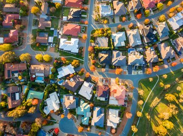
Aerial photography is the production of photographic images from balloons, helicopters or airplanes; it's used primarily for mapping. In 1855, French balloonist Gaspar Felix Tournachon patented the first aerial photography process, though it took three years to produce the first image. Early experiments included using pigeons equipped with automatic cameras and using biplanes in World War I to capture images of enemy trenches. Aerial photography was successfully commercialized by Sherman Fairchild for aerial surveys of land and cities after World War I and has been used in government and civil applications ever since.
Satellite Imagery
The term "satellite imagery" may refer to a number of types of digitally transmitted images taken by artificial satellites orbiting the Earth. The United States launched the first satellite imaging system in 1960 to spy on the Soviet Union. Since then, in addition to military applications, satellite imagery has been used for mapping, environmental monitoring, archaeological surveys and weather prediction. Governments, large corporations and educational institutions make the most use of these images.
Advantages of Satellite Imagery
Satellite imagery has a number of advantages. It can be used to track weather systems, especially dangerous storms like hurricanes, with great accuracy. Satellites circle the Earth, so their imaging activity can be repeated easily. It also allows for much greater areas of coverage and, because all information is digital, it can be easily integrated with software. In some cases, cloud cover does not affect results.
Advantages of Aerial Photography
Aerial photography is still a better choice for most business and personal commercial uses than satellite imagery. Aerial photography costs less and, in some cases, it's more up-to-date, as many available satellite maps are more than a year old and don't necessarily reflect recent changes or developments. Individuals and small companies can more easily hire an aerial photographer and have more input in the process. Resolution and clarity is likely to be higher as well, making images easier to understand and often eliminating the need for special analysis.
References
About the Author
Sean Kotz has been writing professionally since 1988 and is a regular columnist for the Roanoke Times. He has also written for the Blue Ridge Business Journal, The Roanoker, 50 Plus, and Prehistoric Times, among others. He holds a Master of Arts in literature from Virginia Tech.