
Accurate navigation has many important uses, from the relatively simple act of using GPS to safely travel across the city in your car to the more complex navigation of a commercial cruise line across the Atlantic Ocean. Pinpointing your exact location on the Earth can prove to be immensely useful in safe navigation, and that task would be nearly impossible without the geographic grid system. The geographic grid is used to establish exact coordinates for every location on Earth.
What Is the Geographic Grid?
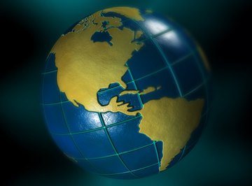
The geographic grid is a set of imaginary lines placed at specific points on the planet. When combined, these lines form a grid pattern. The geographic grid is used to pinpoint exact locations on the planet using the intersections of latitudinal and longitudinal lines. The intersection of these lines is called a coordinate.
Meridians: Lines of Longitude
Lines of longitude, also known as meridians, are imaginary lines that run vertically in a north-south direction from the poles. The meridians come together and meet at the poles, and have their widest separation at the Equator. Most maps show measurements of these lines in increments of 30 degrees. Lines of longitude indicate how far east or west you are of the Prime Meridian.
Important Meridians on the Geographic Grid
The Prime Meridian and the International Date Line are important meridians and points of reference. The Prime Meridian – which runs through Greenwich, England and is sometimes known as the Greenwich Meridian – is the origin point of all other measurements and has a longitudinal designation of zero degrees. We measure other longitudes by the degrees of distance away from the Prime Meridian.
On the opposite side of the globe is the International Date Line, which sits along the 180 degree measurement. The International Date Line is the line of demarcation between calendar days; crossing that line puts you in a different day. Those moving from west to east across the line move forward one day and those moving from east to west move backward one day.
Parallels: Lines of Latitude
Lines of latitude, also known as parallels, run horizontally in an east-west direction. In measuring coordinates, you use these lines to determine where you are in a north-south direction. These lines run around the Earth along and parallel to the Equator, which runs around the widest part of the planet. Essentially, they help you determine how far north or south of the Equator you are!
Important Parallels on the Geographic Grid
There are several important lines of latitude – the Equator, the Tropic of Cancer, the Tropic of Capricorn, the Arctic Circle and the Antarctic Circle. The parallels help determine the climate of a given location, as temperatures typically increase the closer you get to the Equator.
The Equator represents the midpoint of the planet and is where you can find the zero degree measurement. The Tropic of Cancer lies at 23.5 degrees north of the Equator. Conversely, the Tropic of Capricorn lies at 23.5 degrees south of the Equator. The Arctic Circle sits at 66.5 degrees north of the Equator and the Antarctic Circle at 66.5 degrees south.
Coordinates on the Geographic Grid
We pinpoint a specific location on the planet by determining where the lines of latitude and longitude cross one another, or intersect. Coordinates can be given using one of two methods – decimal degrees or degrees, minutes and seconds (DMS).
For example, the coordinates of New York City in decimal degrees:
- Latitude: 40.714
- Longitude: -74.006
And here's an example of the coordinates of New York City in DMS:
- Latitude: 40 degrees, 42 min, 51 sec N
- Longitude: 74 degrees, 0 min, 21 sec W
References
About the Author
Marina Somma is a freelance writer and animal trainer. She holds a B.A. in Psychology and a B.S. in Marine and Environmental Biology & Policy from Monmouth University. Marina has worked with a number of publications involving animal science, behavior and training, including animals.net, SmallDogsAcademy and more.
Photo Credits
earth image by Orlando Florin Rosu from Fotolia.com