
A drainage basin is a portion of land where water from rainfall and snow or ice melt gathers and flows into a body of water. Drainage basins contain streams that funnel water to a larger waterway, such as a river, lake, wetland or ocean. Geographical barriers, such as hills, ridges and mountains separate individual drainage basins. Large basins are comprised of many smaller drainage areas, with the major types of drainage basins categorized by the large body of water that receives the outflow of water.
Ocean Basins
Ocean drainage basins are comprised of large river, lake and other types of basins that ultimately drain into an ocean. Nearly half of all the land on Earth drains through the Atlantic Ocean basin. This ocean basin receives water flow in North America from the Saint Lawrence River, the Great Lakes, the eastern portion of the United States and sections of Canada. Water also flows to this basin from most of South America, central and Western Europe, and Sub-Saharan Africa. The seas of the Mediterranean also are part of the Atlantic Ocean basin. The Pacific Ocean basin receives water from the Western U.S. and Canada, Central America and the Western edge of South America. Additionally, areas bordering the Pacific Ocean also drain into this basin, such as most of China, portions of Russia, Australia and Indonesia. Other ocean drainage basins include the Indian Ocean basin, and the Antarctic Ocean basin, which receives water from Antarctica.
River Basins
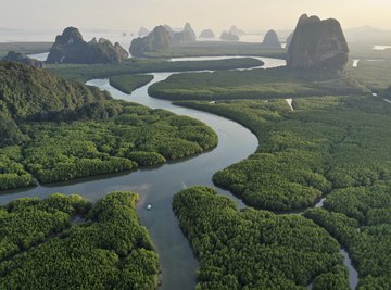
A river basin is a section of land drained by a river and its connected tributaries. The largest river of a river basin drains into an ocean or an enclosed section of water located along the ocean coast, known as an estuary. The major river basins of the world based on the land area drained are the Amazon basin in South America, the Congo basin in Africa and the Mississippi River basin in North America. The Amazon basin drains the most water by volume, with the Congo second and the Ganges River basin in Asia third.
Endorheic Basins
Areas of land that drain to an inland lake or sea with no outflow to an ocean are known as endorheic drainage basins. Water only escapes from these types of basins through evaporation. The largest endorheic basin is in central Asia, which drains to the Caspian and Aral seas. The Great Basin, located in the United States, is the largest endorheic drainage basin in North America. Additional endorheic basins include the Sahara Desert and portions of Africa, Australia, the Arabian Peninsula, the Andes Mountains and Mexico.
Importance
Drainage basins often form boundaries of territory. Drainage basins are used in the study of hydrology, which is the examination of water movement, distribution and quality. These basins also provide a means to study ecology and provide an opportunity for federal, state and local governments to manage water resources through watershed districts.
References
Resources
About the Author
Theresa Custodio is a Michigan-certified nurseryman with over 10 years experience. She has spent over five years working for the State of Michigan's Department of Environmental Quality writing permits and violation notices, which are published for public record. She has a Bachelor of Science degree from Eastern Michigan University with a major in biology and a minor in conservation and resource use.