Meteorologists study cloud formations through satellite images to determine and predict the type of weather expected for a region. Cloud formations happen at multiple layers in the atmosphere, which is a defining factor of how the clouds behave – whether they form into a massive weather system or just drift lazily along.
As an observer standing on the ground and looking up into the sky, you'll see three basic types of clouds: cirrus, stratus and cumulus. Scientists further classify these three cloud types into four distinct subcategories: high, middle and low clouds, based on the altitude of the cloud formation in the atmosphere, and clouds that start low but climb vertically high in the sky.
TL;DR (Too Long; Didn't Read)
The three major types of clouds include cumulus, stratus and cirrus clouds with multiple sub-groupings that occur within these three.
How Clouds Form
When air cools beneath its saturation point, condensation occurs to form clouds. You can observe this process with a small teakettle on a stove. When the stove heats the teakettle, and the water inside the kettle begins to boil, condensation occurs at the spout (which also makes some teapots whistle) because of the cooler air that surrounds the spout. The same thing happens when you exhale moist, warm air from your mouth in winter to form a miniature cloud in front of your mouth.
Three Major Types of Clouds and the Meaning of Their Names
Meteorologists still use the classification system for naming clouds originally created by a British chemist and pharmacist named Luke Howard in 1803. This is called the Linnean system, using words from specific Latin bases. Even with minor modifications over the years, scientists still rely on Howard's naming system for classifying clouds because of its simplicity and efficiency.
Howard assigned cloud names based on their appearance and altitude. He noticed that clouds were either convective – meaning they moved circularly and vertically in the atmosphere – or they appeared layered and stacked atop each other. Another category refers to whether the cloud causes rain or not. All three of the major cloud types have names that originate in Latin:
- Cirrus: The Latin base for this word means "curl," which is why these clouds often look like the horse tails or wispy strands.
- Stratus: Meaning layered, or stretched out. This refers to clouds stretched across the sky in sheets.
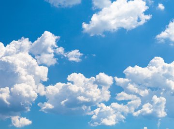
- Cumulus: Means "heap," which is how these clouds appear in the sky: a heaped pile of mashed potatoes or cotton balls haphazardly grouped together.
A Combination of Clouds
Once you learn the three basic types of clouds, the next step is to understand their basic shapes and variations.
Cirrus clouds usually describe clouds high in the atmosphere that can include wispy clouds, typically with ice crystals. Variations include cirrus, cirrocumulus and cirrostratus as defined by the cloud's position in the atmosphere.
Layered stratus clouds have both flat tops and bases, and can appear as if they take up the whole sky, stretching from horizon to horizon. Other combinations and variations include stratus, stratocumulus, nimbostratus and altostratus.
Cumulus clouds often pile up in multiple layers of the atmosphere, representing clouds that develop vertically. Cumulus clouds often look like pillars with anvil-type tops or columns of clouds stacked vertically. Variations include cumulus, cumulus-congestus, cumulonimbus and altocumulus.
Prefixes and Suffixes: Other words to know when it comes to describing clouds include the Latin-based words alto, meaning high; nimbo, from the Latin word nimbus meaning rain_; cumulo_, meaning heap; and cirro, which is the Latin base word for curl. These words appear as prefixes, words that come before another word like cirrocumulus (curled heap), or suffixes, words that appear at the end of another word like cumulonimbus, from the Latin base words cumulo and nimbo, loosely translated to mean heaped rain.
Cloud Classification by Altitude
Clouds occur mostly in the lower layers of the atmosphere in the troposphere, which extends upward from sea level to about 33,000 feet and sometimes into the stratosphere. The reason most clouds develop in the troposphere is because water vapor is more prevalent in this layer. The next layer, the stratosphere, extends from the troposphere up to 31 miles above the ground – the place where ozone exists – in which planes generally fly to avoid most lower-level weather systems. Other layers (where clouds do not appear) include the mesosphere, thermosphere and exosphere.
The altitude and placement of clouds in the atmosphere further help meteorologists and other weather researchers identify the individual cloud characteristics. This in-depth classification immediately tells a weather person what they need to know to predict the weather. Cloud formations occur in low, middle or high layers of the atmosphere, or they form vertically, starting at lower elevations, passing through multiple layers of the sky. Knowing the various cloud names, prefixes and suffixes helps you to more thoroughly understand the cloud names categorized into four distinct groups:
- Low Clouds
- Middle Clouds
- High Clouds
- Vertical Clouds
Low clouds include stratus, stratocumulus and nimbostratus clouds. These clouds typically form at the ground level up to an altitude of about 6,000 feet in the sky. Clouds occurring at ground level are what scientists call fog.
Middle clouds such as altostratus and altocumulus refer to those that occur at approximately 10,000 feet. These clouds typically form between 8,000 feet to 12,000 feet and consist of ice crystals, water droplets or both.
High clouds like cirrus, cirrocumulus and cirrostratus happen at altitudes close to or above 20,000 feet and mostly contain ice crystals.
Vertical clouds include cumulus, cumulus-congestus (congestus meaning piled up) and cumulonimbus. They begin at lower altitudes and cover more than one of the altitude categories. As an example, rain-bearing cumulonimbus clouds often begin at below 6,000 feet and extend upward to altitudes above 20,000 feet.
Clouds and the Water Cycle – Water Storage in the Atmosphere
Clouds play a critical role in the water cycle. The water cycle describes how water moves in and above the planet, how the Earth stores it, and how water moves in a continuous rotation. Clouds form because of the evaporation, transpiration and condensation stages of the water cycle, which in the end, releases water as precipitation.
Evaporation: This is the process that takes liquid water from the Earth or the oceans and converts it into a gaseous or vaporous form. Nearly 90 percent of the moisture in the atmosphere comes from liquid water in lakes, oceans, rivers and seas that turns into a gas or vapor in the atmosphere.
Transpiration: The other 10 percent of water that escapes as a gas or a vapor into the atmosphere comes from plants that release it during the photosynthetic process. As plants take in carbon dioxide, the stomata in plant and tree leaves open, which also allows water to escape into the atmosphere. A small amount of water also escapes into the atmosphere from a process called sublimation, which mostly happens in Arctic areas of the world when ice changes into a vapor without melting.
Condensation: Once water enters the atmosphere in gaseous or vaporous form, it condenses or changes back to water in the atmosphere to form clouds, which is the primary route that allows water to return to the planet.
Precipitation: Clouds then move through the atmosphere, changed and shaped by winds, jet streams, temperatures, and high- and low-pressure systems. When hot and cold air masses meet, and the conditions are right, water begins to fall back to Earth in various forms: mist, rain, snow, sleet, ice and hail.
Weather Lore: Mare's Tales and Fish Scales
Cirrus clouds appear in the upper altitudes of Earth's troposphere and sometimes into the stratosphere, shaped by the winds that occur there, and often signal an approaching weather front that can herald a storm. Sailors of past centuries, who didn't have the technology available to people today, learned to read the skies through experience and passed this knowledge down through rhymes, lore and folktales.
One such rhyme, "mare's tails and mackerel scales make tall ships carry low sails," is a way that sailors identified cirrus clouds on the open seas that foretold of changing weather and more than likely, a coming storm. When you see a combination of mare's tales, which are wispy, curly and feather-like clouds or cirrus clouds combined with patches of clouds that look like fish scales – cirrocumulus clouds – be on the lookout for an upcoming weather front, which remains a true piece of advice even today. Fish-scale cloud patterns often appear at the end of a storm as well, trailing behind the weather front.
Weather Lore: Red Sky at Night, Sailor's Delight
When looking at the sky during the night or morning, the redness of the sky could predict the weather. Sailors say, "Red sky at night, sailor's delight; red sky at morning, sailors take warning." As sailors crossed the threshold into night, right before the sun sets, and saw that the sky was red, it generally indicated that tomorrow's sailing would be clear of weather. When the sky is clear, the setting sun lights up the sky with a red-orange hue, which means the air to the west is clear as many non-cyclone weather systems in the Northern Hemisphere move from west to east. But when the sky is red in the morning, it means the light from the sun in the east is hitting cirrus clouds in the atmosphere and bouncing off the ice crystals within the clouds. Since cirrus-type clouds usually precede a storm, sailors would be ready to batten down the hatches if the sky was red in the morning.
Weather Lore: If Wooly Fleeces Bestow the Heavenly Way
Another piece of sailor lore that holds mostly true is the phrase, "If wooly fleeces bestow the heavenly way, be sure no rain will come today," refers to the puffy cumulus clouds that look like distorted cotton balls in the sky. Most of these types of clouds generally occur in fair weather, dotting the sky with puffs that change shape with the wind or disappear altogether to form in another place in the sky.
Debunking a Myth: Lenticular Clouds Do Not Hide UFOs
One myth that continues to spread is that a peculiar-looking cloud that resembles a giant flat plate is really a cover for a flying saucer. Often called UFO clouds, these clouds typically form next to a mountain (though they can occur elsewhere). These clouds regularly occur along the Pacific Northwest near mountains in the Cascade Range running from the state of Washington through Oregon and into the northern part of California.
Lenticular clouds typically form in the autumn and winter. Because of their location in the atmosphere, lenticular clouds, called altocumulus lenticularis – from the Latin word meaning shaped like a lentil – mostly develop along the ridges and valleys atop or on the sides of mountains. Waves in the atmosphere form when moist air moves up, over and down the side of a mountain; once it cools, the moist air condenses into a saucer-shaped cloud. Sometimes multiple lenticular clouds form atop each other, like a stack of pancakes hovering over the mountain peak.
References
- University of Illinois Extension: Cumulus, Stratus, and Cirrus
- Washington State University: Weathercatch: Cloudy With a Chance of More Clouds
- University of Georgia: Common Cloud Names, Shapes, and Altitudes
- Penn State: Clouds From Bottom to Top
- University of Wisconsin, Madison: How Are Clouds Named?
- University Corporation for Atmospheric Research: Layers of Earth's Atmosphere
- USGS: Precipitation: The Water Cycle
- Universities Space Research Association: Cloud Shadow Projection
- Met Office: Cumulonimbus Clouds
- University of Massachusetts: Cloud Atlas
- Washington State University: Lenticular Clouds – The Truth Is Out There
- The Natural Navigator: Weather Lore
About the Author
As a journalist and editor for several years, Laurie Brenner has covered many topics in her writings, but science is one of her first loves. Her stint as Manager of the California State Mining and Mineral Museum in California's gold country served to deepen her interest in science which she now fulfills by writing for online science websites. Brenner is also a published sci-fi author. She graduated from San Diego's Coleman College in 1972.