Home Sweet Home
Hacks, Tips & Tricks
Squeaky Clean
DIY Decor
Carpentry & Remodeling
Maintenance & Repair
Green Thumb
All Home Sweet Home
Chow Down
Main Dishes
Sweet Treats
Snacks
Copycat Recipes
Drinks & Cocktails
Sides & Appetizers
Veggie Faves
Food Hacks
All Chow Down
Get Crafty
Sew Simple
Fun Crafts
Art Projects
All Get Crafty
Let’s Celebrate
Valentine's Day
St. Patrick's Day
Easter
Mother's Day
Father's Day
4th of July
Back to School
Halloween
Thanksgiving
Christmas
New Year
Weddings
Baby Showers
Birthdays
Parties & Events
Gifts
All Let’s Celebrate
JOIN OUR NEWSLETTER
JOIN OUR NEWSLETTER
Home
Home Sweet Home
Green Thumb
Green Thumb
By
Teo Spengler
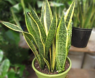
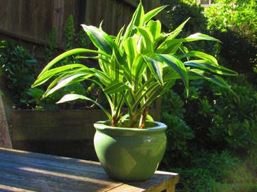
Houseplant Help: Snake Plant (Dracaena trifasciata)
Home Sweet Home
By
Teo Spengler
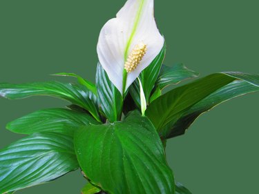
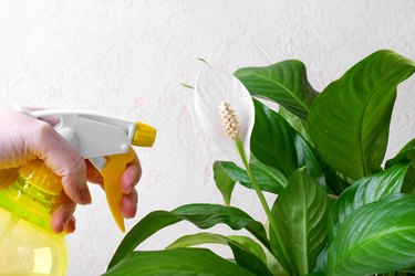
Houseplant Help: Peace Lily (Spathiphyllum)
Home Sweet Home
By
Teo Spengler
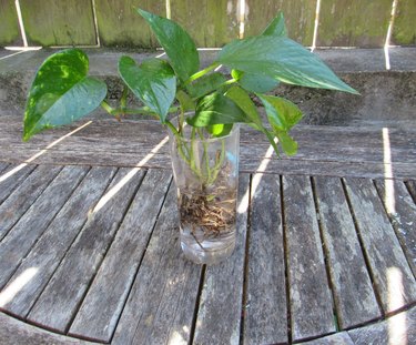
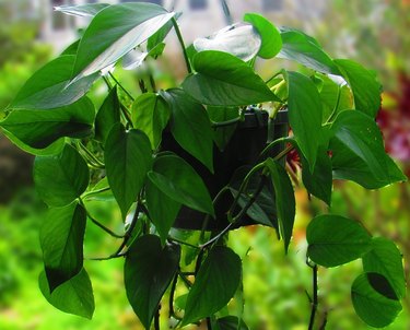
How to Propagate Pothos
Home Sweet Home
By
Teo Spengler
What to Plant In Your Garden In Early Spring
Home Sweet Home
By
Teo Spengler
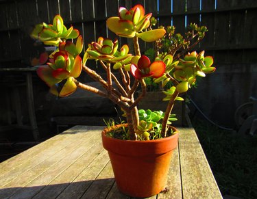
Houseplant Help: Jade Plant (Crassula ovata)
Home Sweet Home
By
Teo Spengler
Houseplant Help: Golden Pothos (Epipremnum aureum)
Home Sweet Home
By
Teo Spengler
Houseplant Help: Dracaena fragrans (Corn Plant)
Home Sweet Home
By
Teo Spengler
New USDA Plant Hardiness Zone Map — What's Your Zone Now?
Home Sweet Home
By
Damarys Ocaña Perez
Detroit Hives Is on a Mission: To Save Bees & Build Community
Home Sweet Home
By
Joyce Starr
Tomato Gardening Must-Haves for Your Best Bounty Yet
Home Sweet Home
By
Joyce Starr
Grow an Edible Countertop Forest With These Microgreens Growing Kits
Home Sweet Home
By
Joyce Starr
Protect Raised Garden Beds From Common Pests Using These Products
Home Sweet Home
By
Joyce Starr
Herb Drying Racks for Preserving Your Homegrown Bounty
Home Sweet Home
By
Joyce Starr
Vertical Garden Planters That Are Perfect for Small Outdoor Spaces
Home Sweet Home
By
Joyce Starr
Shield Your Head and Neck From the Sun With These Gardening Hats
Home Sweet Home
By
Joyce Starr
Add Charm to Your Garden Landscaping With One of These Arches
Home Sweet Home
By
Joyce Starr
Wall Planters That Maximize Space Beautifully
Home Sweet Home
By
Fred Decker
Make the Most of Your Small Backyard Garden
Home Sweet Home
By
Joyce Starr
Plant Misters to Keep Your Humidity-Loving Plants Happy
Home Sweet Home
By
Joyce Starr
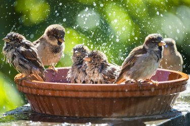
The 7 Best Birdbaths to Attract More Birds to Your Yard
Home Sweet Home
By
Joyce Starr
Pollinator-Friendly Wildflower Seed Mixes to Plant This Spring
Home Sweet Home
By
Joyce Starr
Gnat Traps to Keep Your Houseplants Pest-Free
Home Sweet Home
By
Joyce Starr
Create Your Own Tabletop Garden With a Terrarium Kit
Home Sweet Home
By
Joyce Starr
A Fun-Guide to Mushroom Growing Kits
Home Sweet Home
By
Joyce Starr
Fungicides That Will Protect Your Houseplants
Home Sweet Home
By
Joyce Starr
Useful Products That Will Help Keep Your Precious Orchids Alive
Home Sweet Home
By
Joyce Starr
Houseplants to Gift Your Valentine—Because They'll Last Longer Than Flowers
Home Sweet Home
By
Joyce Starr
Buy These Seed Starter Kits Before Spring Arrives
Home Sweet Home
By
Joyce Starr
Protect Your Houseplants With These Safe Pest Control Products
Home Sweet Home
By
Joyce Starr
These Grow Lights Will Help Your Indoor Plants Find Their "Inner Grow"
Home Sweet Home
By
Joyce Starr
Houseplant Help: 8 Potting Mixes to Make Your Indoor Plants Shine
Home Sweet Home
By
Joyce Starr
Keep Your Seasonal Garden Faves Handy With These Seed Storage Containers
Home Sweet Home
By
Joyce Starr
Grow a Garden Right on Your Countertop With These Indoor Hydroponic Systems
Home Sweet Home
By
Joyce Starr
Rare Succulents You Can Buy on Etsy
Home Sweet Home
By
Joyce Starr
Portable Greenhouses for Your Backyard or Balcony
Home Sweet Home
By
Damarys Ocaña Perez
Meet Our Makers of the Month: Judy Bao & Thong La of Judy Bao's Garden!
Home Sweet Home
1
2
3
4
5
>
Report an Issue
Contact*:
Severity*:
High
Normal
Low
Description*:
Screenshot loading...
Cancel
Submit