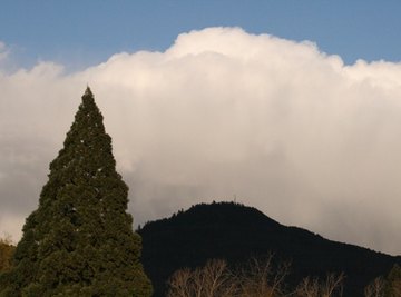
Topography refers to the contour of the physical landscape; it is roughly synonymous with “terrain.” A topographic description of a swath of country takes into account the lay of the land: the peaks and valleys, the drainage network, the scarps and depressions. Measuring topography can refer to mathematical assessments of elevation and streamflow, or it can mean defining various geologic and geographic variables to describe a region. A classic and familiar example of the output of measuring terrain is a topographic map, showing with its contours and shading the heights and lows of the country.

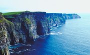
Measure the heights and depths of the terrain. A topographic map’s contour lines derive from regularly measured or extrapolated elevations. Geographers and geologists accomplish this through any number of methods. Modern-day remote sensing and satellite imagery analysis has made such topographic assessments much easier, but on-the-ground surveying, a much older method, still is commonly used. The elevations of mountain peaks can be ascertained, for example, using tools like transits, with which the angle between the measuring vantage and the sighted summit is taken at two points; the surveyor then constructs a triangle with those two angles as corners and geometrically calculates the mountain’s height (see Reference 1).

Take measurements of rivers. Stream systems are among the great sculptors of terrain: They erode not just actively in their channels, but also as rocks and sediments slide from the slopes of their valleys and canyons. River floodplains form as the “shoulders” of channels; flooding events spill waters out of the channels and deposit rich sediments in the floodplain. Stream measurements include such aspects as width, depth, discharge speed and volume and stream order, which examines the relationship between tributaries and mainstem drainages. More detailed hydrologic surveys would also take into consideration the height of a stream when it leaps its banks, as well as its height when it begins to affect human structures, properties and lives -- the so-called “flood stage" (see Reference 2).

Classify the area’s soil and rock types. These are other means of measuring topography: describing the soil and geological profile that underlie the surface landscape. Analyzing geomorphology means understanding why and how the existing landforms came to be. For example, you might be considering a broad, gentle uplift of granite, pockmarked here and there with boulders of the same classification, and surrounded by more level sedimentary terrain. This could suggest the topography owes its existence to an intrusion of granite, as in a batholith, that has better resisted the forces of erosion than surrounding sedimentary rocks.
References
About the Author
Ethan Shaw is an independent naturalist and freelance outdoors/nature writer based in Oregon. He holds a B.S. in Wildlife Ecology and a graduate certificate in G.I.S. from the University of Wisconsin-Madison. His primary interests from both a fieldwork and writing perspective include landscape ecology, geomorphology, the classification of ecosystems, biogeography, wildlife/habitat relationships, and historical ecology. He’s written for a variety of outlets, including Earth Touch News, RootsRated, Backpacker, Terrain.org, and Atlas Obscura, and is presently working on a field guide.
Photo Credits
landscape image by pearlguy from Fotolia.com