
The latitude and longitude system identifies a position on the Earth's sphere based on the Equator and the Prime Meridian, which is the longitude line that crosses Greenwich in England. This is a universally recognized method of expressing a location and therefore it is better to use latitude and longitude than non-standard scales that may appear on certain maps. It is not difficult to convert grid coordinates to latitude and longitude, as both use a Cartesian plane, where the Equator and Prime Meridian are the x- and y-axis respectively. However, unless regional maps offer latitude and longitude scales, conversion is possible only on world maps.
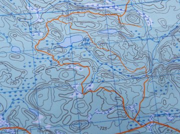
Regional Maps with Scales
Determine a location’s position on the map based on your coordinates. For example, count from left to right and from bottom to top to locate position (3,5), where the first number is the horizontal axis value and the second number is the vertical axis value. Mark the spot with a pencil.
Place the ruler on the map horizontally, connecting your spot with the nearest latitude scale (the vertical bars on the left and right end of the map containing angular values). Place a dot on the scale to mark your location's latitude value. Move the ruler to a vertical position and repeat the process with your spot and the nearest longitude scale (horizontal bars on the top and bottom side of the map).
Write down the latitude and longitude values using the following format: 37° 59' 0" N / 23° 44' 0" E. The prime and double prime symbols refer to minutes and seconds, which are subdivisions of the angular degree.
World Map Conversion
- Pencil
- Ruler
Measure the length of the x-axis in inches, starting from point 0 and ending at the left and right side of the map. This is to establish that the distance on both directions is equal and the coordinate plane is centered on the map. Repeat the process with y-axis and the top and bottom sides of the map.
Divide the length of the x-axis by 180 and the y-axis by 90. This will give you the equivalent of each latitude (LA) and longitude (LO) angle in inches.
Mark the coordinates of a location on the two axes. For example, place a dot on number 3 of the x-axis and on number 5 of the y-axis to locate position (3,5).
Measure the distance between the start of the axes and the dots. Multiply the distance of the x-axis by LO to calculate the longitude of the spot. Do the multiplication of the distance on the y-axis by LA to calculate latitude.
Write down latitude and longitude as 65.45 N / 32.12 W. Using decimals is an acceptable method of expressing latitude and longitude values without using minutes and seconds.
Things You'll Need
About the Author
Tasos Vossos has been a professional journalist since 2008. He has previously worked as a staff writer for "Eleftheros Tipos," a leading newspaper of Greece, and is currently a London-based sports reporter for Perform Sports Media in the United Kingdom. He holds a Bachelor of Arts in communication and media from the University of Athens.
Photo Credits
Jupiterimages/Photos.com/Getty Images