
A grid on a city map makes it easy to find a place in the city. The grid divides the geographic area into convenient sections bordered by lines whose intersections create convenient reference points.
Grid Map-Making Instructions
- City map
- Sheet of paper larger than the city map
- Regular sheet of paper
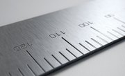
- Ruler
- Compass
- Pen or pencil
Title the map to signify the historical importance of the map to the area.
Make a map of your city. Using a compass, orient the top of the large map page to true north. Copy a map at the same size and scale on the paper, or use the city map to draw a map to scale.
Measure the width and height of the map in inches. Divide the number of miles in the area from west to east by the number of inches in the map's width. This division will tell you the number of miles per inch in your map scale.
Make a rectangular grid box for 1-inch grid squares. Using the ruler, draw a rectangle on the map around the entire city area.
Divide the rectangle into 1-inch grid squares. Beginning at the bottom, measure up 1 inch and draw a parallel line from left to right on the horizontal. Measure up another inch and draw a parallel line until you have less than 1 inch to the top. Beginning at the left side, measure right 1 inch and draw a meridian line from bottom to top at a right angle to the bottom parallel line. Measure right another inch, and draw a meridian line until you have less than 1 inch to the right side.
Designate the grid-square rows with letters and the grid square columns with numbers. On the left and right sides, write letters from A at the top to the highest letter at the bottom. On the bottom and top, write numbers from 1 at the left to the highest number at the right.
If you know the degrees latitude and longitude on the original city map, index the grid lines to latitude and longitude. Use a sheet of paper to calculate the index.
For latitude, divide the height of the map in inches by the total degrees of latitude in the map—the difference between the southernmost and northernmost latitude. This result gives you the degrees latitude in each grid square. Begin at the first parallel above the bottom parallel. For each parallel, add the degrees latitude in one grid square to the latitude of the parallel below it.
For longitude, divide the width of the map in inches by the total degrees of longitude in the map—the difference between the westernmost longitude and the easternmost longitude. This result gives you the degrees longitude in each grid square. Begin at the first meridian at the right of the left meridian. For each meridian, add the degrees longitude in one grid square to the longitude of the meridian to the left. On the back of the map, write an index with the latitude for each parallel and the longitude for each meridian.
Add a map title, date, compass rose, scale and legend.
Things You'll Need
Tips
References
About the Author
Adam Benjamin Pollack is a San Diego native dedicated to the great sentences on civil society. He authored the Subchapter S Report to tell legal news for the American Bankers Association. He holds a Juris Doctor from Indiana University and a Master of Public Policy from University of California, Berkeley.
Photo Credits
poster with world map image by Attila Toro from Fotolia.com