


To fully comprehend the nature of a land, you must study its influence on its people. Likewise, human beings cannot be understood without considering the land where its life takes place. At the physical level, populations develop characteristics for adaptation to their environments. For example, sea level inhabitants or those around bodies of water are shorter on average than those living in the mountains, and residents in cold climates are likely to be lighter-skinned than their tropical counterparts. Geography influences their vocabularies, too. Human beings living in a verdant region may have many words for the subtle variations of the color green, while the language of a seagoing nation may include an unusually high number of nautical terms. Geographical features influence both the languages and physical characteristics of a place’s inhabitants.
Physical Geography
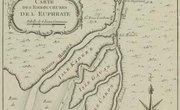
Geographic conditions – whether a land is on a seacoast, in the mountains, among the grasslands or in the forest – influence the economic and social development of the people. Finding a food source is the first concern. Can food be secured by fishing, hunting, gathering native plants or farming, or are there minerals, lumber or gems that can be traded for food? Populations on small islands, because of their isolation, will probably be excluded from having a large impact on history. Landforms that are shut off from the rest of the world by mountains or sea tend to foster a homogeneous people, while those sharing larger land masses are more likely to adopt characteristics of neighboring cultures, according to "Influences of Geographic Environment," a 1911 book by Ellen C. Semple, whose text was converted by a group from the University of Colorado in 1997.
Effects of Climate
Generally, the habitat where a person was raised tends to hold him, because it dictates the range of climate that he can endure. When the first Europeans came to the lowlands of tropical India, the debilitating climate stripped them of the qualities that had first given them supremacy, the Semple book says. Those who have to overcome the extremes of climate in their daily lives acquire a tenacity and strength of character not required in by less demanding geographic factors in other parts of the world. Though climate change will continue to force a place’s inhabitants to adapt to their ecosystem. Throughout history different cultures have evolved ways to cope with environmental challenges. Many human societies derive tradition and spiritual beliefs from characteristics of their ecosystems– natural disasters may be a product of an angry god, for example. Cultural diversity will continue to reflect these climate changes.
Evolving from Nomads to Settlers
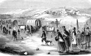
One example is the nomadic Comanche tribe of northern Texas which held its territory and the game living on it as the common property of the tribe. This was typical of the human activity of early nomads, but the relationship with the land changed when societies merged and economic activities advanced. As permanent settlements were established, private ownership became the norm with a great emphasis on accumulation in all forms, Semple reported in her book. Wars became common over natural resources and the acquisition or retention of territory. First, human settlements were erected for agricultural purposes and the gathering of such natural resources. Industrialism and commerce followed which led to widespread globalization. Economic development was a primary goal as humans sought to export goods they had in abundance in exchange for things they were not able to produce.
Development of Cities
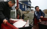
With the coming of the Industrial Revolution, cities were formed so factory workers could live close to their new workplaces. Everyday life rapidly changed for the average citizen. City locations were selected where there were more geographic advantages than disadvantages. The point where mountain ranges converge or where land and sea meet might be attractive because it offered the benefits of both features, a Johns Hopkins University article said. Transportation needed to be feasible by both land and waterway, if possible. People considering settling near water had to weigh the risks of storms that could cause flooding. The physical environment was now important for reasons other than agricultural production. In fact, people now frequently choose to live or not live in a place based on its climate and the potential for economic growth. The study of the earth has become a way to determine ideal living locations.
Conservation of Natural Settings
Few cultures feel more of a responsibility to their land and resources as the Hawaiian people, according to The Nature Conservancy's Hawaiian branch. This unique state, made up of several races, diverse geographical forms and far from the rest of the country, has an intimate relationship with its natural setting. The lyrics of many of its songs and chants reflect this respect. Hawaiians put the needs of the land first, knowing that when these are met, the land can support the people living on it.
Related Articles


References
Writer Bio
Mary Simpson began her writing career in 1968 on a Dallas oil magazine. Besides reporting and editing for several small Texas newspapers, Simpson has written for "Petroleum Engineer Magazine," "Denton Today Magazine" and put out an employee newsletter for a FEMA facility. She holds a B.A. in journalism and an M.A.in English, both from the University of North Texas.