While traditional GPS units select the generally fastest route between a user's current location and their destination, their routing algorithms can't take into account unexpected conditions. GPS-generated directions can become irrelevant or even counterproductive when faced with traffic accidents, lane closures or severe weather. To increase the number of variables that the GPS computer can consider when proposing a route, some models include the ability to receive wireless live traffic data.
How GPS Works
Video of the Day
The Global Positioning System, or GPS, is a "constellation" of more than 24 satellites, known as Navstar, operated by the U.S. Department of Defense. These satellites are about 11,500 above the earth, traveling at 9,000 mph and each has an atomic clock with the exact time. These satellites are synchronized to broadcast a signal simultaneously. GPS receivers, like those in a car, passively monitor these broadcasts. Although the signals travel at the speed of light, the great distances involved mean that each signal arrives at a slightly different time. Calculating the time differences between each satellite, a GPS receiver can pinpoint its own location.
Video of the Day
From location to address
After receiving satellite broadcast signals from the satellites, a GPS receiver can calculate its own longitude and latitude. With at least four satellite signals, it can also determine its height above the earth, which is useful for GPS receivers in the air, on the sea, or in mountainous regions. Based on its exact longitude and latitude, the GPS can translate its location to a specific street or intersection.
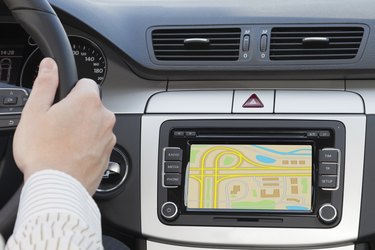
Calculating the route
To calculate a route from that information, the GPS database must also include data such as the lengths of various roads, traffic flow rules and the locations of intersections. The onboard database can also include more detailed information, such as whether certain roads are highways or local streets, well-paved or one-lane gravel. The database can also include factors like the average speed on a given road at various times of day, and any other number of variables that are relevant to route planning. These variables will be ones that tend to change infrequently or never. With good programming, this data increases the probability of the GPS unit selecting a good route.
Live Traffic
To incorporate data about ever-changing traffic and road conditions, however, GPS units must be able to receive live information over the air. One way to do this is by radio transmissions over frequencies that are close to the frequencies used by your car stereo. By using "sidebands" or the Radio Data Service (RDS), providers such as MSN Direct and Navteq send digitized traffic (and often weather and news) information to equipped GPS units from local radio transmitters. Cars with built-in Sirius/XM satellite radio and GPS systems can also receive live traffic information in the background over the satellite radio signal. This information will be automatically incorporated into the GPS system's route. These services usually require a subscription. The above systems are also "one-way:" while the mobile GPS unit receives data from the traffic information source, it doesn't communicate any information back.
Two-way data
Cellular phones equipped with a GPS processor can often receive not just their position, but also live traffic information over the cellular network. Some commercial GPS receivers also include cellular or radio communications capability. Because these systems are "two-way," a user can rapidly receive updated traffic information for a requested area. Some systems can also transmit back anonymous information on the GPS unit's current location and speed, to help the data provider build a picture of traffic on a given road that can then assist other users.